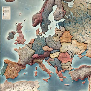
Boundaries
Refers to the defined edges or limits of geographic areas, such as countries, states, provinces, cities, districts, and neighborhoods, as well as natural regions like watersheds, mountain ranges, and conservation areas. These boundaries serve as critical reference points for mapping, spatial analysis, governance, and resource management, helping organizations, governments, and businesses understand territorial divisions and regional relationships.
Administrative boundaries, such as national borders, state lines, and municipal zones, are essential for legal and political purposes, defining jurisdictional authority, electoral districts, and public service areas. These divisions help government agencies allocate funding, enforce laws, and manage infrastructure projects. Similarly, natural boundaries, such as rivers, coastlines, and ecological zones, are used in environmental conservation, disaster management, and land-use planning.
In the commercial sector, boundary data is widely used for market segmentation, logistics, and real estate planning. Businesses analyze these geographic limits to determine store locations, target advertising campaigns, and optimize supply chain routes. Financial institutions use boundary information to assess economic zones and guide investment decisions, while telecommunications companies use it to plan network expansion and coverage areas.
Advancements in Geographic Information Systems (GIS), satellite mapping, and AI-driven spatial analysis have made boundary mapping more precise and dynamic. Modern boundary datasets integrate real-time demographic trends, land-use changes, and infrastructure developments, enabling decision-makers to adapt strategies based on evolving geographic and socio-economic conditions. Whether for governance, commerce, environmental research, or urban planning, boundaries provide a foundational framework for understanding and managing geographic spaces effectively.
Dataset Details
Need help choosing a dataset?
Contact us for more information:
Discover high-quality geospatial datasets tailored for professional use in logistics, mapping, and data analytics. Our catalog includes detailed location-based data by country, format, partner, and update frequency. All datasets are curated for accuracy, consistency, and usability across industries. Whether you’re building smart city applications or improving route planning, our data supports informed decision-making.
Browse by region or partner to find the dataset that fits your needs. Need help selecting the right format or version? Contact our team for expert guidance.
Trusted by businesses across Europe and beyond, our data solutions are built to scale.