For many GIS professionals, one of the biggest bottlenecks isn’t analysis – it’s finding and preparing high-quality, consistent spatial data. Analysts often spend more time cleaning, converting, and organizing data than deriving insights from it. The HERE GIS Data Suite was created to solve exactly that challenge by delivering a ready-to-use, high-integrity GIS foundation that integrates seamlessly with Esri environments.
What Is the HERE GIS Data Suite?
The HERE GIS Data Suite is a comprehensive, foundational dataset designed to support GIS workflows – especially for users of Esri’s ArcGIS platform. Instead of manually sourcing and transforming location data from disparate sources, GIS professionals receive a unified, pre-configured package that’s ready for analysis as soon as it’s opened.
At its core, the suite combines HERE’s industry-leading location data with Esri-friendly formatting, eliminating hours of prep work and accelerating project timelines.
Key Features of the Suite
The strength of the HERE GIS Data Suite lies in the way it delivers high-quality geospatial content that is immediately usable within GIS workflows. Instead of assembling datasets from multiple sources, users receive a preconfigured ArcGIS Pro project that is already structured, layered, and symbolized. This allows GIS professionals to open the project and begin analysis right away, without spending time on setup or data preparation.
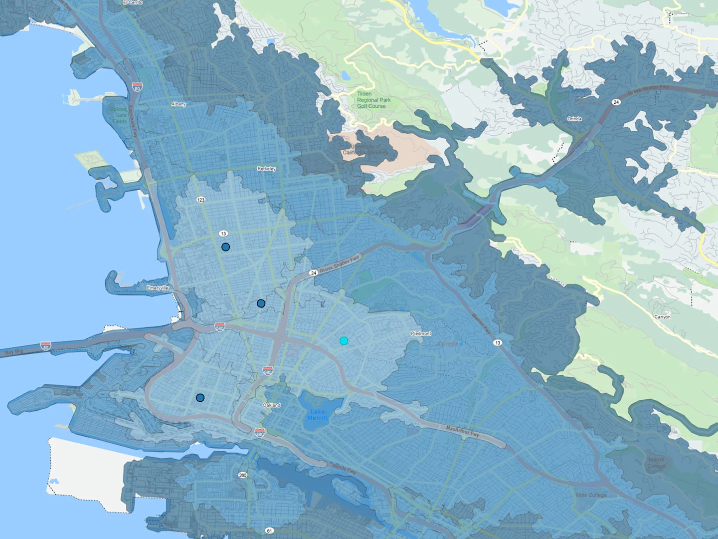
At the core of the suite is a robust network dataset that supports advanced spatial analysis such as routing, travel time calculations, and service area modeling. This makes it particularly valuable for use cases in transportation planning, logistics, and accessibility analysis, where network accuracy directly impacts decision-making.
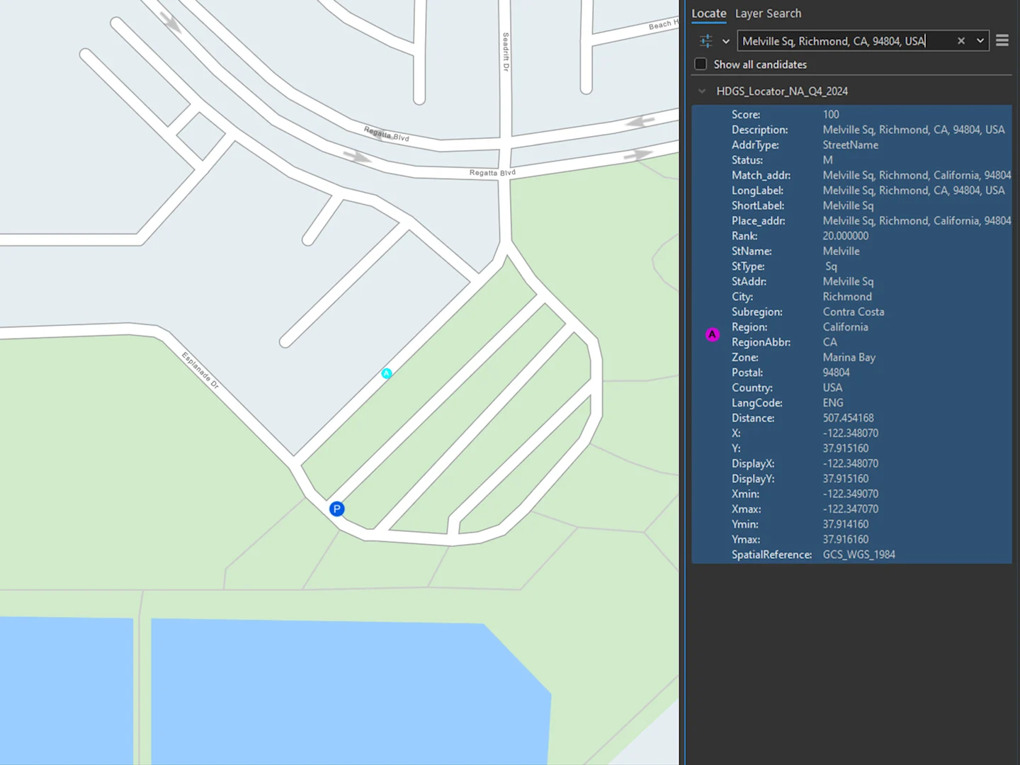
Accurate location analysis is further supported by high-precision locator files. These enable reliable geocoding and reverse geocoding for addresses, micro-locations, and points of interest, ensuring that spatial data can be matched to real-world locations with a high degree of confidence.
The suite also includes rich places and POI data, covering everything from landmarks to commercial locations. Each feature is enhanced with detailed attributes, allowing users to perform deeper analysis, filtering, and visualization based on real-world place information.
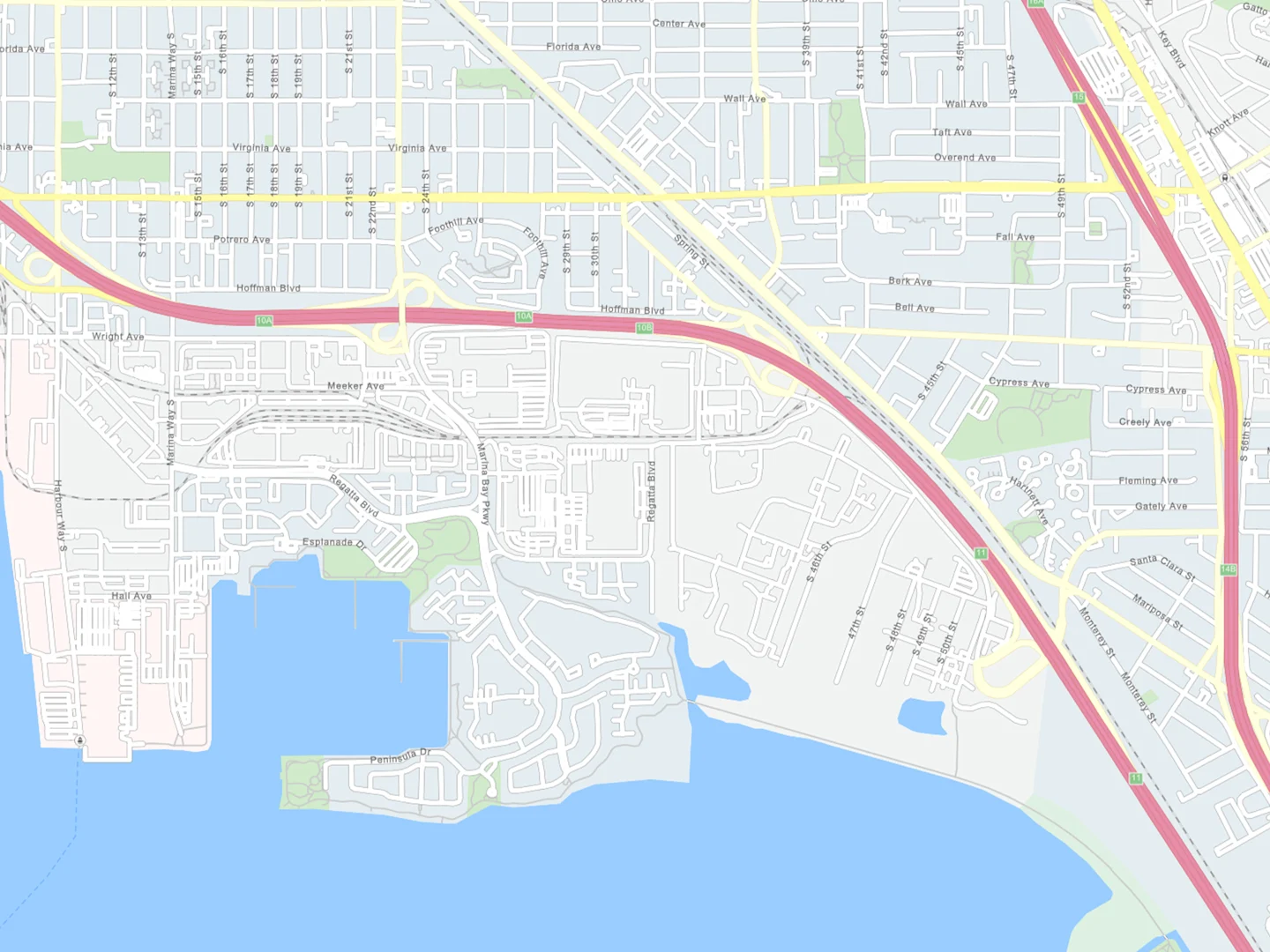
For visualization and cartographic presentation, the HERE GIS Data Suite provides vector tile packages in both color and grayscale. These basemaps are optimized for performance and deliver a clean, professional look, making them suitable for both analytical maps and presentation-ready outputs.
Finally, comprehensive road network attributes complete the dataset. Up-to-date information on speed limits, toll roads, and vehicle restrictions such as height and weight limits makes the suite especially relevant for transportation, mobility, and logistics scenarios where regulatory and physical constraints must be accurately modeled.
Why This Matters to GIS Teams
For GIS teams, time is often lost long before analysis even begins. Sourcing, validating, and cleaning raw geospatial data can consume a significant portion of any project. The HERE GIS Data Suite removes much of this friction by providing ready-to-use, consistently structured data, allowing analysts to spend their time generating insights rather than managing datasets.
Data quality and reliability are equally critical, especially when GIS outputs inform operational or strategic decisions. By relying on high-integrity location data from a provider with decades of experience, teams can work with greater confidence and reduce the risk associated with incomplete, outdated, or inconsistent spatial information.
Keeping GIS data current is another ongoing challenge. With global quarterly updates, the GIS Data Suite reflects real-world changes such as new infrastructure, updated addressing, and evolving transport networks. This ensures analyses remain relevant over time, even as the physical world continues to change.
Finally, the suite offers flexibility in geographic coverage. Organizations can select data for a specific country, region, or a custom-defined area of interest, ensuring the solution fits both the scope of the project and the available budget-without paying for unnecessary coverage.
Who Benefits Most?
The HERE GIS Data Suite is particularly valuable for:
- GIS Analysts and Engineers needing reliable foundational data
- Urban Planners and Transportation Experts working on routing and infrastructure projects
- Public Sector and Government Agencies running spatial analysis and service planning
- Logistics and Supply Chain Teams modeling network performance and routing scenarios
- Researchers and Academia requiring consistent base data for studies and models
Conclusion: A New Standard in GIS Data
With the HERE GIS Data Suite, professionals can finally sidestep the repetitive grunt work of data preparation and jump straight into analysis and insight generation. By delivering rich, pre-configured, and up-to-date data that integrates seamlessly with Esri workflows, the suite sets a new benchmark for how foundational GIS data should work – letting teams focus on driving value and solving real-world problems.
—————————————————————————————————————————————————————
Interested to learn more about the HERE GIS Data Suite? 👉