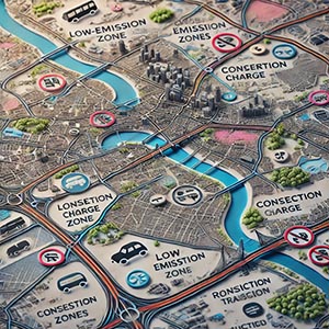
Environmental Zones
Designated geographic areas where regulations are implemented to reduce environmental impact, improve air quality, and promote sustainable urban mobility. These zones impose restrictions on certain types of vehicles, emissions levels, and industrial activities, ensuring compliance with environmental policies and supporting long-term ecological goals.
Environmental zones include Low Emission Zones (LEZs), Ultra Low Emission Zones (ULEZs), Clean Air Zones (CAZs), and Zero Emission Zones (ZEZs), each with specific requirements for vehicle access. By regulating traffic and emissions in densely populated or high-pollution areas, these zones help mitigate air pollution, decrease greenhouse gas emissions, and encourage the adoption of cleaner transportation alternatives such as electric vehicles (EVs), bicycles, and public transit.
Mapped Environmental Zones provide crucial data for city planners, transportation authorities, and logistics companies by enabling real-time route adjustments, optimizing fleet management, and ensuring compliance with regional environmental regulations. Businesses that rely on vehicle transportation can use this data to avoid restricted areas, reduce penalties, and transition toward more eco-friendly operations.
Additionally, environmental zones play a key role in urban planning, health policy, and climate change mitigation by reducing respiratory illnesses linked to air pollution and fostering sustainable city growth. Governments and policymakers leverage environmental zone data to assess air quality improvements, plan green infrastructure, and enforce sustainability measures effectively.
By integrating Environmental Zones into navigation systems, fleet management tools, and urban planning initiatives, cities and businesses can enhance regulatory compliance, support environmental sustainability, and contribute to a cleaner, healthier living environment for future generations.
Dataset Details
Need help choosing a dataset?
Contact us for more information:
Discover high-quality geospatial datasets tailored for professional use in logistics, mapping, and data analytics. Our catalog includes detailed location-based data by country, format, partner, and update frequency. All datasets are curated for accuracy, consistency, and usability across industries. Whether you’re building smart city applications or improving route planning, our data supports informed decision-making.
Browse by region or partner to find the dataset that fits your needs. Need help selecting the right format or version? Contact our team for expert guidance.
Trusted by businesses across Europe and beyond, our data solutions are built to scale.