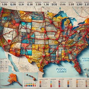
Postal Code Boundaries
Geographic areas designated for specific postal codes, defining the spatial regions used for efficient mail delivery, logistics, and address-based services. These boundaries serve as an essential framework for routing, demographic analysis, and service planning, ensuring accurate distribution of postal services while also supporting various commercial, governmental, and logistical operations.
Postal code boundaries play a crucial role in optimizing mail sorting and delivery routes, helping postal services and couriers reduce travel distances and improve efficiency. By defining precise geographic zones, businesses and organizations can better understand customer distribution, market potential, and service availability. This data is widely used in sectors such as real estate, telecommunications, and retail for sales territory planning, targeted marketing, and location-based decision-making.
In addition to commercial applications, postal code boundaries support urban planning and public services, assisting governments in resource allocation, emergency response coordination, and infrastructure development. Geographic Information Systems (GIS) and mapping applications integrate these boundaries to enhance geospatial analysis, helping users visualize population density, socio-economic trends, and accessibility to key services.
Whether for improving logistics, refining business strategies, or supporting regional planning, Postal Code Boundariesprovide a vital spatial reference that enhances operational efficiency and decision-making across multiple industries.
Dataset Details
Need help choosing a dataset?
Contact us for more information:
Discover high-quality geospatial datasets tailored for professional use in logistics, mapping, and data analytics. Our catalog includes detailed location-based data by country, format, partner, and update frequency. All datasets are curated for accuracy, consistency, and usability across industries. Whether you’re building smart city applications or improving route planning, our data supports informed decision-making.
Browse by region or partner to find the dataset that fits your needs. Need help selecting the right format or version? Contact our team for expert guidance.
Trusted by businesses across Europe and beyond, our data solutions are built to scale.