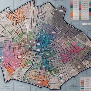
High Resolution Postcode Sector Boundaries
Detailed and precise geographic delineations of postcode sectors, offering an essential dataset for a wide range of industries across Great Britain. These boundaries provide a granular view of postal regions, enabling businesses, government agencies, and researchers to conduct in-depth spatial analysis, gain valuable demographic insights, and optimize logistics operations. By leveraging this dataset, organizations can enhance targeted marketing campaigns, streamline delivery routes, and improve service area planning.
It also plays a crucial role in infrastructure development, urban planning, and emergency response coordination by offering accurate location intelligence. Businesses in retail, real estate, and telecommunications can use postcode sector boundaries to identify market trends, allocate resources efficiently, and refine customer engagement strategies. With high-resolution precision, this dataset supports data-driven decision-making, operational efficiency, and strategic planning for a variety of applications throughout Great Britain.
Dataset Details
| Partner | |
|---|---|
| Country |
Need help choosing a dataset?
Contact us for more information:
Discover high-quality geospatial datasets tailored for professional use in logistics, mapping, and data analytics. Our catalog includes detailed location-based data by country, format, partner, and update frequency. All datasets are curated for accuracy, consistency, and usability across industries. Whether you’re building smart city applications or improving route planning, our data supports informed decision-making.
Browse by region or partner to find the dataset that fits your needs. Need help selecting the right format or version? Contact our team for expert guidance.
Trusted by businesses across Europe and beyond, our data solutions are built to scale.