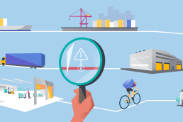
Location intelligence (LI) solutions have become essential for businesses that rely on spatial data to make informed decisions. From fleet management and logistics to retail site selection and urban mobility applications, solution providers and integrators require access to accurate map data, routing, geocoding, traffic analytics, and real-time updates.
With so many options available, one of the biggest decisions integrators face is whether to use free/open-source solutions or paid/commercial solutions. Both have advantages, but the choice depends on factors like project scale, accuracy requirements, regulatory compliance, and budget.
This blog compares paid and free location intelligence solutions, helping you determine which is best for your business.
What Are Location Intelligence Solutions?
Location intelligence combines geospatial data and analytics to help organizations make better decisions. Solution providers and integrators use LI solutions to:
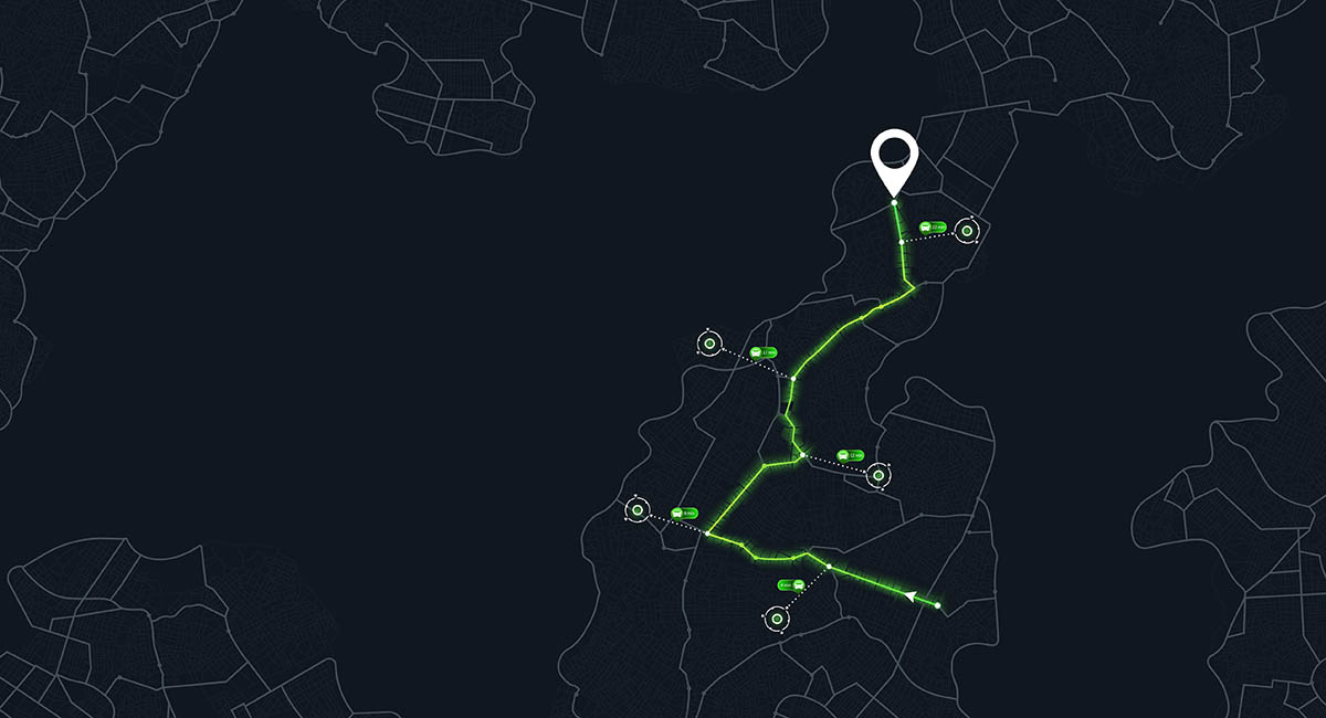
- Optimize logistics and route planning (e.g., dynamic route optimization for fleets)
- Identify the best retail or warehouse locations (demographic and POI analysis)
- Enhance mobility and navigation apps (real-time traffic and public transport data)
- Support emergency response and government planning (geofencing, hazard mapping)
Typical data & functionalities include:
- Base maps and satellite imagery
- Geocoding and reverse geocoding
- Routing, traffic, and historical movement analytics
- Geofencing and proximity alerts
- Heatmaps and data visualization dashboards
The right combination of these functionalities can significantly impact service quality, operational efficiency, and customer experience.
Free Location Intelligence Solutions: Advantages and Limitations
Free or open-source location intelligence solutions—such as OpenStreetMap (OSM), Leaflet, and QGIS—are popular among developers for their accessibility.
✅ Advantages
- Cost-effective: Free to use, making them ideal for MVPs, academic research, or low-budget projects.
- Open-source flexibility: Source code can be customized to fit unique integration requirements.
- Strong developer community: Large communities contribute to plugins, updates, and support.
❌ Limitations
- Data accuracy & freshness: Updates may lag behind commercial providers, especially in less-mapped regions.
- Coverage gaps: POI density and road network details can be inconsistent globally.
- Scalability & performance: Free APIs often have strict request limits and may not support enterprise-scale applications.
- No dedicated support: Problem-solving relies on community forums rather than service-level agreements (SLAs).
- Licensing risks: Some open-source licenses have restrictions for commercial use.
Paid Location Intelligence Solutions: Advantages and Limitations
Paid solutions from providers like HERE Technologies, Google Maps Platform, TomTom, and Mapbox are designed for enterprise-grade applications.
✅ Advantages
- High-quality, accurate, and regularly updated data – crucial for navigation, logistics, and government services.
- Global coverage & enriched POI databases – reliable in both developed and emerging markets.
- Advanced functionalities – real-time traffic, historical analytics, predictive routing, and EV-specific data.
- Scalability – High API request limits with consistent performance.
- Dedicated enterprise support & SLAs – ensures reliability for mission-critical services.
- Regulatory compliance – essential for industries requiring GDPR or other data privacy adherence.
❌ Limitations
- Cost: Usage-based pricing can become significant for high-volume API calls.
- Vendor lock-in: Switching providers can be complex and expensive.
- Less control over data: Unlike open-source, raw data customization is often limited.

Paid vs. Free: When to Choose Which?
| Factor | Free / Open-Source | Paid / Commercial |
| Project Stage | Ideal for prototypes, MVPs, academic projects | Best for production-grade, revenue-generating services |
| Data Accuracy | Varies by region, community-driven | Consistently accurate and frequently updated |
| Scalability | Limited by API rate limits | Designed for high-volume enterprise use |
| Support | Community forums only | 24/7 enterprise support & SLAs |
| Compliance | Potential licensing risks | Clear licensing, GDPR-compliant |
| Budget | Free or low-cost hosting | Paid licenses & usage-based pricing |
The Hybrid Approach: Best of Both Worlds
Many solution providers use a hybrid approach to balance cost and quality. Examples include:
- Using OpenStreetMap for base maps but leveraging HERE or TomTom for routing and real-time traffic.
- Combining open-source visualization tools (Leaflet, Kepler.gl) with paid geocoding and POI layers.
This strategy reduces costs while maintaining enterprise-grade reliability for critical functions.
Conclusion
Free location intelligence solutions are excellent for experimentation and low-cost projects, but they have limitations in terms of data accuracy, scalability, and support. Paid solutions offer enterprise-grade quality, compliance, and reliability, making them the best choice for mission-critical applications.
If you are a solution provider or integrator looking to deliver scalable, high-quality location-based services, paid solutions—or a hybrid approach—are worth considering.
—————————————————————————————————————————————————————
At Local Eyes, we provide location intelligence solutions tailored for integrators and solution providers. Our services combine high-quality commercial data sources with flexible integration options, giving you the best of both worlds.
👉 Contact us today to discuss which solution fits your needs.