Location intelligence has become ingrained in the everyday lives of billions of people. Without even realising it, many of our interactions with it happen out more of a habit and many of our activities leverage the depth of the technology innately.
Its influence is felt in so many ways – not least in business where its impact spans infrastructure, automotive, communications, as well as the Internet of Things (IoT) and mobile services, to name a few sectors.
Let’s consider a few ways location intelligence is making a big impact right now.
Smart Cities
Infrastructure will see huge changes in the coming years with the implementation of more efficient information systems which collect data about traffic, vehicles and usage of different modes of transport to their algorithms – to best direct movement and to ease the congestion associated with this.
In fact, in San Diego, US, street lighting includes sensors to measure air quality and foot traffic, parking and vehicle counts – all of which is fed back to a central data centre. More data means better decision-making; as well as both energy and cost savings.
Waste Disposal
Another great example of a new technology employing location intelligence is through ‘smart’ trash cans which indicate when they’re at full capacity using wireless sensors.
Initiatives like these have been rolled out in cities like Amsterdam and Helsinki – and it’s estimated that savings using this system, which relies heavily on accurate mapping, could significantly reduce the cost of collection.
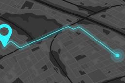
How? Well, the mapping technology required for this system generates the most efficient routes for vehicles to take when their collections go from a static route to a dynamic one.
Last Mile Logistics
Many domestic users of location services only consider their interactions on a 2D map– as in the streets that they walk around, the location of service providers, and the distance between points. However, businesses focusing on the commercial use of drones know that the world is 3D.
Drone deliveries, specifically last mile logistics which focus on the final step in delivery, need accurate building height data to ensure drones don’t crash or cause accidents. The mapping technology is being built and both drone companies and delivery operations are fully invested in its advancement.
Driverless Vehicles
Driverless cars were the stuff of sci-fi in principle a few decades ago. They continue to dominate headlines – but not always for the right reasons. Testing accidents continue to plague their adoption.
Nonetheless, the technology will continue to improve. Their rollout is a case of ‘when’ – not if. However, as it stands the location intelligence and mapping systems used are watertight and do not in any way limit the way in which driverless cars operate.
The main problems relate to the ways in which the vehicles are programmed and requires many complex social interactions which are still tough for robots – essentially a hardware, rather than software fault.
All of these emerging technologies – and many others – are coming to the fray knowing that the location intelligence is already ahead of the game. In fact, location intelligence is now so advanced that many companies using it are playing catch up in other areas, investing in new hardware to enable them to fully make use of it.
Because location intelligence acts as a base layer for many new projects, its impact can often be underestimated, but given the way in which it can be used in all kinds of sectors, its application is only limited by what people realise is possible – for now at least.