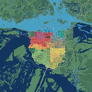
6-digit Postcode Boundaries LDU
A highly detailed dataset providing precise geographic boundary data for Canadian postcodes at the Local Delivery Unit (LDU) level, enabling accurate spatial analysis and strategic decision-making. This dataset offers granular insights into postal regions, supporting refined geographic analysis, urban planning, targeted marketing, and delivery optimization within smaller, well-defined postal areas. Businesses can use these boundaries to enhance customer segmentation, optimize distribution networks, and streamline last-mile delivery logistics.
Government agencies and urban planners benefit from this data by improving infrastructure development, public service planning, and resource allocation. Retailers and service providers can leverage LDU boundaries for hyper-local marketing campaigns, ensuring more effective outreach to specific communities. By incorporating this detailed postcode data into their operations, organizations can enhance efficiency, make data-driven decisions, and improve overall service delivery across Canada’s diverse and dynamic regions.
Dataset Details
Need help choosing a dataset?
Contact us for more information:
Discover high-quality geospatial datasets tailored for professional use in logistics, mapping, and data analytics. Our catalog includes detailed location-based data by country, format, partner, and update frequency. All datasets are curated for accuracy, consistency, and usability across industries. Whether you’re building smart city applications or improving route planning, our data supports informed decision-making.
Browse by region or partner to find the dataset that fits your needs. Need help selecting the right format or version? Contact our team for expert guidance.
Trusted by businesses across Europe and beyond, our data solutions are built to scale.