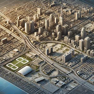
Enhanced Cartographic Buildings
A high-precision dataset featuring detailed 3D representations of buildings, designed to enhance the realism and accuracy of digital maps, Geographic Information Systems (GIS), and spatial analysis applications. These models incorporate textures, shadows, and precise dimensions, creating a lifelike visualization of urban and rural landscapes. By providing a true-to-scale representation of buildings, this dataset significantly improves mapping experiences, aiding in navigation, location-based services, and infrastructure planning.
Enhanced 3D building models are essential for urban development and smart city initiatives, offering architects, engineers, and city planners detailed insights into the built environment. These representations help assess building density, evaluate zoning regulations, and simulate construction projects, ensuring better decision-making for infrastructure expansion and environmental impact assessments. The dataset also supports emergency response planning, helping authorities understand structural layouts for faster and more effective disaster management and rescue operations.
In navigation and wayfinding applications, Enhanced Cartographic Buildings improve user experiences by providing more intuitive map visualizations. Drivers, cyclists, and pedestrians can benefit from more recognizable landmarks and detailed urban models, making orientation and navigation more seamless. Additionally, logistics and transportation companies can optimize routes by understanding urban layouts, high-rise obstructions, and access points with greater accuracy.
Beyond urban planning and transportation, industries such as real estate, tourism, and telecommunications also rely on 3D building models. Real estate developers use them for virtual property tours and site analysis, while tourism platforms incorporate them into interactive city guides. Telecom companies leverage building data for network planning, optimizing signal coverage, and placing infrastructure such as 5G towers more efficiently.
By integrating Enhanced Cartographic Buildings into geospatial solutions, businesses, governments, and researchers can improve spatial analysis, enhance digital mapping experiences, and make more informed decisions. Whether for navigation, infrastructure planning, or immersive mapping applications, this dataset provides a critical resource for better understanding and visualizing the built environment.
Dataset Details
| Partner | |
|---|---|
| Update Frequency | |
| Region | Asia Pacific, Eurasian Economic Union, Middle East and Africa, North America, Oceania, South America, Western European Union |
| Country |
Need help choosing a dataset?
Contact us for more information:
Discover high-quality geospatial datasets tailored for professional use in logistics, mapping, and data analytics. Our catalog includes detailed location-based data by country, format, partner, and update frequency. All datasets are curated for accuracy, consistency, and usability across industries. Whether you’re building smart city applications or improving route planning, our data supports informed decision-making.
Browse by region or partner to find the dataset that fits your needs. Need help selecting the right format or version? Contact our team for expert guidance.
Trusted by businesses across Europe and beyond, our data solutions are built to scale.

