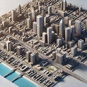
Enhanced Cartographic Buildings Asia Pacific
Detailed 3D representations of buildings in maps, often with textures, shadows, and accurate dimensions. They improve visual accuracy and realism in digital maps or GIS, aiding urban planning, navigation, and location-based services with a lifelike view.
Dataset Details
| Region |
|---|
Need help choosing a dataset?
Contact us for more information:
Discover high-quality geospatial datasets tailored for professional use in logistics, mapping, and data analytics. Our catalog includes detailed location-based data by country, format, partner, and update frequency. All datasets are curated for accuracy, consistency, and usability across industries. Whether you’re building smart city applications or improving route planning, our data supports informed decision-making.
Browse by region or partner to find the dataset that fits your needs. Need help selecting the right format or version? Contact our team for expert guidance.
Trusted by businesses across Europe and beyond, our data solutions are built to scale.