Extended Listings EEU
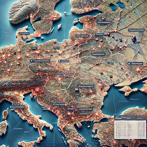
A comprehensive dataset providing detailed geographic and attribute information about locations, infrastructure, and key entities across Eastern European countries. This dataset offers enriched, region-specific geospatial data that enhances spatial analysis, urban planning, and data-driven decision-making for businesses, government agencies, and research institutions. By including precise details on businesses, public services, transportation networks, and essential infrastructure, it enables organizations to gain deeper insights into geographic trends, optimize operations, and improve strategic planning.
Extended Listings EEU supports a wide range of applications, including logistics, real estate, telecommunications, and commercial development. Businesses can leverage this dataset for site selection, competitive analysis, and targeted marketing, while city planners and policymakers can use it to improve public service delivery, zoning regulations, and infrastructure investment. Additionally, navigation services and mapping applications benefit from the dataset by improving route planning, location accuracy, and accessibility insights. By providing up-to-date, high-quality geographic information, Extended Listings EEU helps organizations across industries make smarter, more efficient, and regionally tailored decisions in Eastern Europe.
Dataset Details
| Partner |
|---|
Need help choosing a dataset?
Contact us for more information:
Discover high-quality geospatial datasets tailored for professional use in logistics, mapping, and data analytics. Our catalog includes detailed location-based data by country, format, partner, and update frequency. All datasets are curated for accuracy, consistency, and usability across industries. Whether you’re building smart city applications or improving route planning, our data supports informed decision-making.
Browse by region or partner to find the dataset that fits your needs. Need help selecting the right format or version? Contact our team for expert guidance.
Trusted by businesses across Europe and beyond, our data solutions are built to scale.