GIS and Mapping
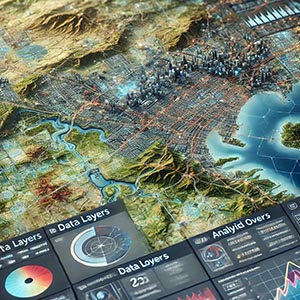
The use of specialized software, tools, and technologies to collect, analyze, interpret, and visualize spatial data, enabling the creation of accurate maps and geographic models. Geographic Information Systems (GIS) allow users to integrate various layers of data, such as demographics, land use, transportation networks, and environmental factors, to support decision-making across multiple industries and scientific disciplines.
By combining geospatial data with advanced analytical tools, GIS and Mapping help users gain deeper insights into geographic phenomena, such as urban growth patterns, climate change, and natural resource distribution. This technology is widely applied in fields like urban planning, disaster management, agriculture, transportation, and environmental conservation, providing critical information for sustainable development and policy-making.
Modern GIS platforms enable users to perform spatial analysis, identify trends, and predict future changes by overlaying datasets and using advanced algorithms. Interactive mapping applications, such as web-based GIS tools and mobile mapping solutions, further enhance accessibility and usability by allowing real-time data visualization and collaboration. Businesses and government agencies leverage GIS to optimize logistics, improve public infrastructure, and manage natural disasters more effectively.
As technology continues to evolve, GIS and Mapping integrate with artificial intelligence, remote sensing, and real-time location data, making geographic analysis more powerful and precise. Whether used for navigation, resource management, or strategic planning, GIS remains an essential tool for understanding spatial relationships and solving complex geographic challenges in an increasingly data-driven world.
Dataset Details
Need help choosing a dataset?
Contact us for more information:
Discover high-quality geospatial datasets tailored for professional use in logistics, mapping, and data analytics. Our catalog includes detailed location-based data by country, format, partner, and update frequency. All datasets are curated for accuracy, consistency, and usability across industries. Whether you’re building smart city applications or improving route planning, our data supports informed decision-making.
Browse by region or partner to find the dataset that fits your needs. Need help selecting the right format or version? Contact our team for expert guidance.
Trusted by businesses across Europe and beyond, our data solutions are built to scale.