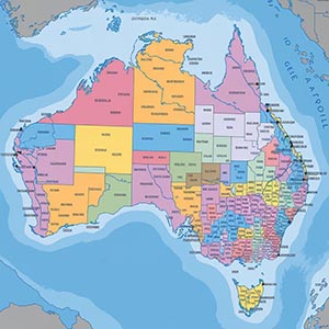
4-digit Postcode Boundaries
A comprehensive dataset outlining the detailed geographic boundaries for Australian postcodes, providing essential spatial data for a wide range of applications. These boundaries enable accurate mapping, in-depth location analysis, and valuable demographic insights, supporting businesses, government agencies, and researchers in making data-driven decisions. By defining postal regions with precision, this dataset helps optimize logistics, streamline delivery networks, and enhance service area planning.
Businesses can use postcode boundaries for targeted marketing, identifying customer distribution patterns, and improving market segmentation strategies. Additionally, urban planners, policymakers, and infrastructure developers can leverage this data to enhance regional planning, public service allocation, and transportation networks. With its high level of accuracy and coverage, this dataset plays a crucial role in supporting operational efficiency, strategic planning, and economic development across Australia’s diverse postal regions.
Dataset Details
| Partner | |
|---|---|
| Country | |
| Postcode Digit |
Need help choosing a dataset?
Contact us for more information:
Discover high-quality geospatial datasets tailored for professional use in logistics, mapping, and data analytics. Our catalog includes detailed location-based data by country, format, partner, and update frequency. All datasets are curated for accuracy, consistency, and usability across industries. Whether you’re building smart city applications or improving route planning, our data supports informed decision-making.
Browse by region or partner to find the dataset that fits your needs. Need help selecting the right format or version? Contact our team for expert guidance.
Trusted by businesses across Europe and beyond, our data solutions are built to scale.