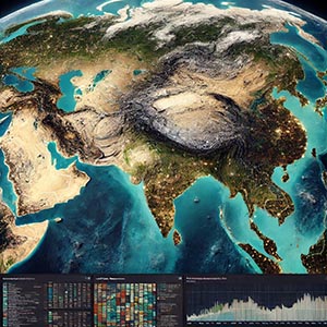
High-resolution photographs and geospatial data captured by satellites, providing detailed and comprehensive views of Earth’s surface from space. This imagery enables precise mapping, land use analysis, environmental monitoring, and disaster response efforts, offering valuable insights through advanced spatial data interpretation. By capturing up-to-date images across vast areas, satellite imagery plays a critical role in various industries, including agriculture, urban planning, defense, and climate science.
Satellite imagery supports mapping and cartography by providing highly accurate and detailed visual representations of terrain, infrastructure, and natural landscapes. It is widely used in land use analysis, helping researchers and policymakers track urban expansion, deforestation, and agricultural development. Environmental monitoring applications leverage satellite data to observe changes in ecosystems, detect pollution levels, and assess the impact of climate change on glaciers, coastlines, and forests.
Additionally, satellite imagery is essential in disaster management, enabling rapid assessment of affected areas after natural disasters such as hurricanes, earthquakes, floods, and wildfires. Emergency responders, humanitarian organizations, and government agencies use this data to plan relief efforts, allocate resources efficiently, and improve disaster preparedness. Industries such as energy, real estate, and infrastructure development also rely on satellite imagery for site selection, monitoring construction progress, and assessing geological conditions.
By integrating satellite imagery with Geographic Information Systems (GIS) and artificial intelligence, businesses and researchers can analyze spatial patterns, predict future trends, and make data-driven decisions. Whether used for navigation, environmental conservation, or global security, Satellite Imagery remains a powerful tool for capturing and interpreting Earth’s changing landscapes with unparalleled accuracy.